1
/
of
3
18 in stock
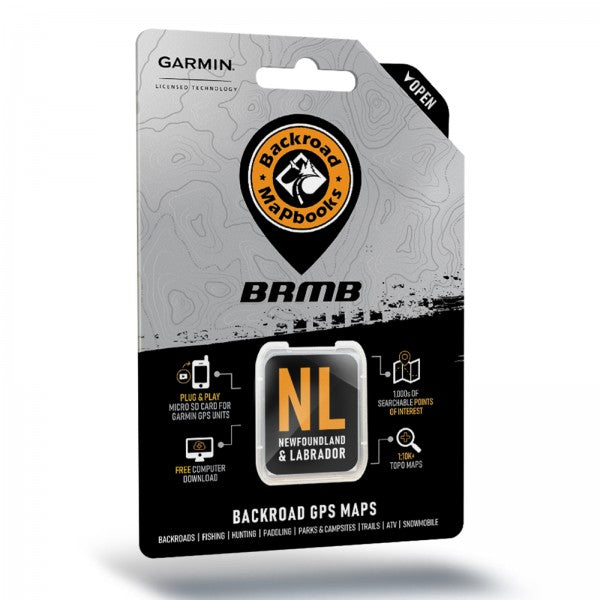
Newfoundland and Labrador Backroad GPS Maps
Newfoundland and Labrador Backroad GPS Maps
Part #NFLDSD
Regular price
$69.99 CAD
Regular price
$0.00 CAD
Sale price
$69.99 CAD
Unit price
/
per
Shipping calculated at checkout.
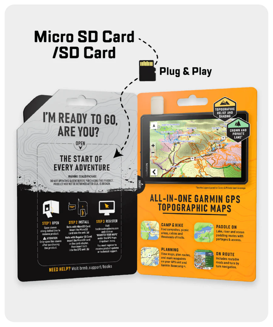
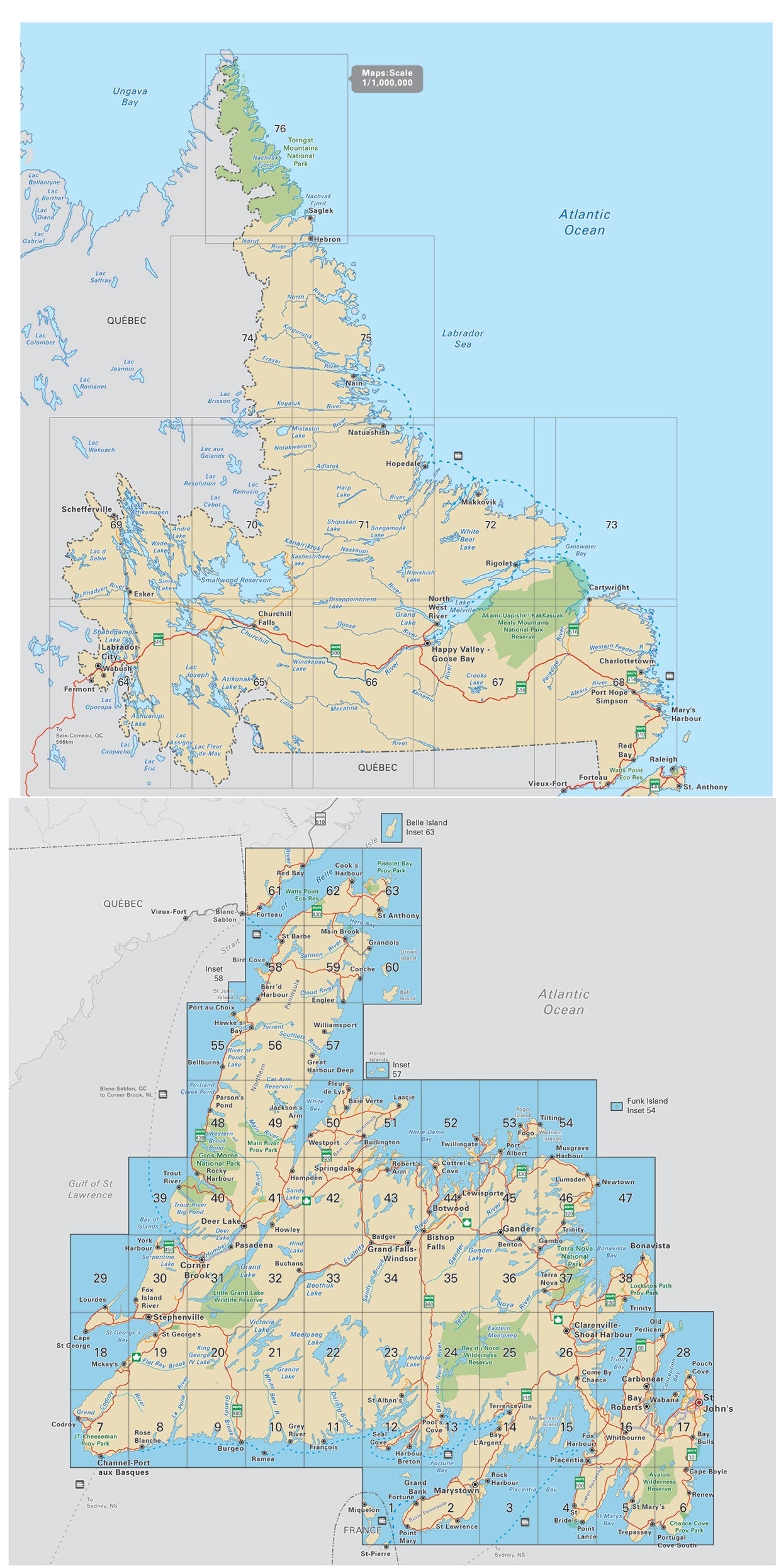
- Combining day-to-day navigation with enhanced outdoor recreation information, this product combines all of Newfoundland and Labrador into one Backroad GPS Map.
- Over 39,000 km of our backroads network combined into one map, including over 20,000 km of routable roads.
- Marked Cariboo Management Areas (CMA) and Moose Management Areas (MMA) for hunters.
- Address Search tool makes navigating easier than ever.
- Thousands of kilometres of ATV Trails, snowmobile routes, multi-use hiking, biking and cross-country skiing trails and paddling routes, with marked trailheads and access points/portages.
- Thousands of fishing hotspots, parks and conservation areas, campsites, hunting areas, winter recreation areas and more.
- Over 25,000 land and water geographic features.
- Enhanced cartography for improved display of parks, conservation areas, creeks and activity Points of Interest.
- Improved snowmobile route lines, First Nations reserve coverage and railway corridor mile markers.
- Backroad Extras
Backroad Extras are where you find all the POI information specific to our Backroad GPS Maps.
Points of Interest (POI)
Unique to BRMB’s Newfoundland & Labrador GPS Maps are feature POI sets of tens of thousands of searchable points with close to 400 fishing lakes and rivers and close to 200 paddling routes with access points and portages. These points come complete with descriptions geo-referenced from our popular Backroad Mapbook series.
Note: Backroad POIs can be searched by selecting the Where To/Find > Extras and then Go! option, or you can read what each site offers through the More option.
Custom POI Highlights
- Close to 120 Cariboo Management Areas (CMA) and Moose Management Areas (MMA) for hunters
- Fishing Lakes and Rivers with close to 400 locations with descriptions and fish species
- Over 15 Boat Launch locations
- Over 330 Trails with front country and backcountry locations and descriptions
- ATV Trails with over 50 trailhead locations and descriptions
- Snowmobile Trails with over 115 trailhead locations and descriptions
- Parks with over 110 National, Provincial and Regional Park locations and descriptions
- Over 40 Backcountry campsites
- Close to 150 Campground and Picnic locations
- 85 Lighthouses
- Paddling with close to 200 paddling route access points descriptions and portage locations
- Wildlife Viewing with close to 45 locations and descriptions
- Over 60 Winter Recreation Sites and Downhill Ski Areas
- Close to 1,300 City, Town and Community locations
- Over 25,000 searchable land and water geographic features
Categories
- Backroad Attractions
- ATV-OHV Trails
- Backcountry Camps
- Boat Launches
- Campsites
- Cities
- Fishing Lakes, Rivers, Streams, Ocean
- Golf Courses
- Hunting Areas
- Huts
- Land Features
- Lighthouses
- Lodging
- Paddling Access
- Paddling Routes
- Parks – Provincial – National - Urban
- Picnic Areas
- Portage Locations
- Public Services
- Resource Facilities
- Restaurants
- Rivers and Creeks
- Snowmobile Routes
- Trails
- Transportation Services
- Visitor Information
- Water Features
- Waterfalls
- Wildlife Viewing
- Winter Recreation
Couldn't load pickup availability
Share